Hallstatt Street by Street: From the South End to the Postcard View
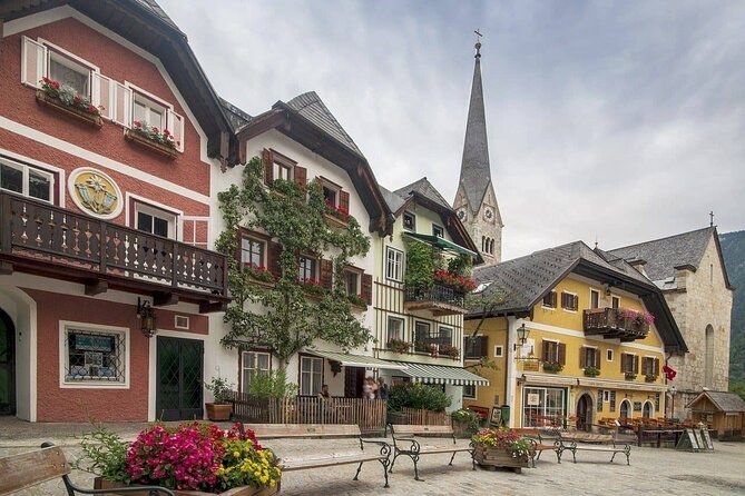
The short answer. The village is one long lakeside strip, and the easy way to see it is south to north: from the coach stop and the funicular, along the lakeshore road and past the museum, onto the square, up to the parish church and its charnel house, down past the Lutheran church, and out to the famous view at the far end. It takes about two hours at an easy pace. A Hallstatt walking tour covers the same ground with someone to explain it.
How the village is laid out
Hallstatt is squeezed between the mountain and the lake, so there is only one way through it: the lakeshore road, with lanes and steps climbing off it. There is no loop. You walk in from one end and out at the other, or turn back. The village map shows the car parks, the stops and the ferry landing along the way.
| Stretch | What is there | Cost | Time |
|---|---|---|---|
| The south end | Coach and bus stop, the funicular | Free; funicular €29 | 10 minutes, or an hour up top |
| The lakeshore road | Houses on the water, the museum | Free; museum €12 | 20 minutes, or an hour inside |
| The square | Painted houses, the stone column | Free | 15 minutes |
| The parish church | The church, its graveyard, the charnel house | Free; charnel house €2 | 30 minutes |
| The Lutheran church | The spire by the water | Free | 10 minutes |
| The north end | The classic view back over the roofs | Free | 15 minutes |
The south end: the stop and the funicular
Coaches and buses stop at Lahn, at the southern edge of the village, and this is where most visitors start. The valley station of the Salzbergbahn funicular is here too. It climbs to the high valley, the World Heritage Skywalk and the Hallstatt Salt Mine, and since the footpath up is closed, it is the only way up. Go first thing if you want the platform without a queue.
The lakeshore road and the museum
Walking north, the road narrows between houses built on the water's edge on one side and on the rock on the other. This stretch is where the village feels stacked, one row of houses above the next up the slope. Museum Hallstatt, at Seestraße 56, tells the story of the salt and of the Iron Age culture named after the village; it costs €12 and is open daily, with shorter hours in winter.
The square
The road opens onto the Marktplatz, the small square at the centre of the village, lined with painted houses and a stone column in the middle. It is the picture on most postcards after the view from the north, and it was copied, house for house, in a replica village in Guangdong Province, China. In the middle of the day it is crowded; early in the morning you have it to yourself.
Up to the parish church and the charnel house
Steps climb from the square to the Catholic parish church, Maria am Berg, on a terrace above the roofs, with its mountain graveyard. Beside it, in St. Michael's Chapel, which dates back to the 12th century, is the Bone House (Beinhaus), with over 600 painted skulls, many labelled with names or initials. It opens daily from April to October and from Wednesday to Sunday in winter, for €2. The way up is by steps or by the steeper church path.
The Lutheran church by the water
Back down on the lakeshore, the tall white spire at the water's edge belongs to the Lutheran church, built from 1859, with a tower 53 m high. It is the spire in every photograph of the village. It is free to visit and sits beside the ferry landing, where the Stefanie crosses to the station and the round-trip boats leave in season.
The north end and the famous view
Keep walking north along the lake and the road climbs a little onto Gosaumühlstraße. A short way past the last houses you reach the spot where the classic photograph is taken: the roofs, the spire and the lake with the mountain behind. Stand to one side: people live in the houses around it. The light is best in the morning, when the sun is on the village.
Photographing the village
You have three classic angles, and each one wants a different time of day. The first is the view from the north end, back over the roofs to the spire: come early, when the sun is on the houses and the path is empty. The second is from the water: take the round-trip boat in season, or the station ferry at any time of year, and look back as you pull away. The third is from above, on the platform at the top of the funicular, where you look straight down onto the roofs and along the lake. If you only have time for one, choose the one that suits your day: the morning view if you are staying the night, the platform if you arrive on a coach at midday.
What most visitors walk past
- The mountain graveyard beside the parish church, still in use.
- The names and initials painted on the skulls, which keep each family's dead together.
- The steep lanes behind the square, where the village climbs away from the crowds.
- The view back from the boat, which is the only place you see the whole village at once.
A route that works
Start at the south end, go up by funicular first if you want the platform, then walk north: the lakeshore, the museum, the square, the church above it, the Lutheran church, and the view at the end. Allow two hours on foot, three with the museum, and an hour more for the platform. With a guide of your own, the two-hour walk from the square covers the churches and the square, and ends outside the museum. For the season when each sight opens, see the best time to visit, and for the paid sights in more depth, things to do. The facts behind all of this are in our post on what surprises visitors.
Days with someone to show you round
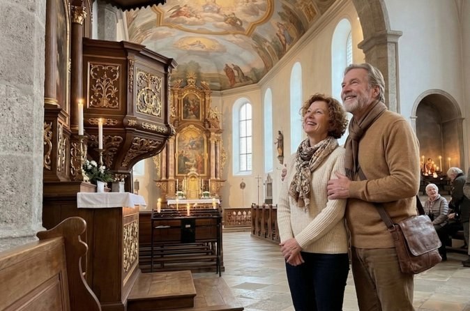
Private Walking Tour in Hallstatt Historic Market & Churches
Two hours on foot with a local guide of your own: the square and its houses, the parish church on the hill and the Lutheran church on the lake, ending outside the museum.
From $449 per person
Check Availability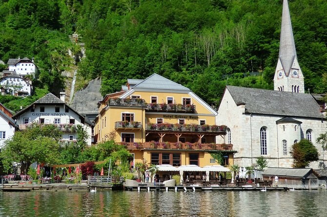
Hallstatt Private Walk Tour With A Professional Guide
An hour and a half on foot with a local guide for your group alone, up to fifteen, from the monument on the lakeside road. You shape the route with your guide.
From $299 per group (up to 15)
Check Availability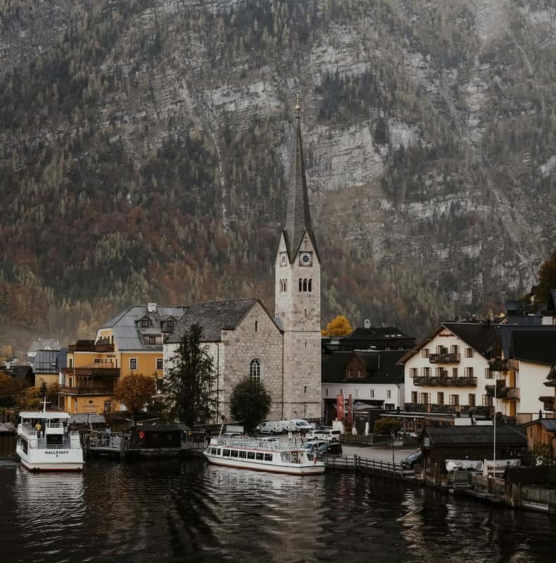
From Vienna to Hallstatt: Europe’s Most Beautiful Village
Twelve hours from Vienna with 3.5 in the village: an hour's guided walk, then two and a half hours for photos and lunch. Bottled water is on board.
From $68 per person
Check AvailabilityNext: Walk the village south to north, then book the walk that lets a local fill in what you passed. Every fare sits side by side on Hallstatt Tours.